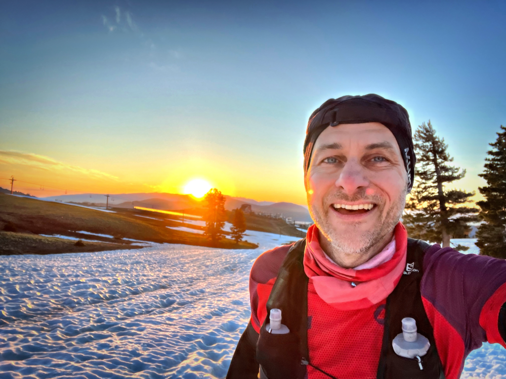
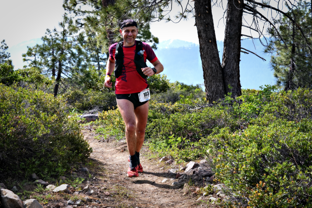
Olympic Valley California, Saturday 24th of June 2023 05:00. 379 runners from all over the world start the climb to Emigrant Pass at 2667m. And I cannot stop the tears from rolling down my cheeks. The western states endurance run has started, and with that, the end of an eight year long quest to get here.
Section 1 – Start to Lyon Ridge
| Total time | Position | Total distance | Time | Distance | Speed |
| 2:15:30 | 48 | 16,6 km | 2:15:30 | 16,6 km | 8:11 min/km |
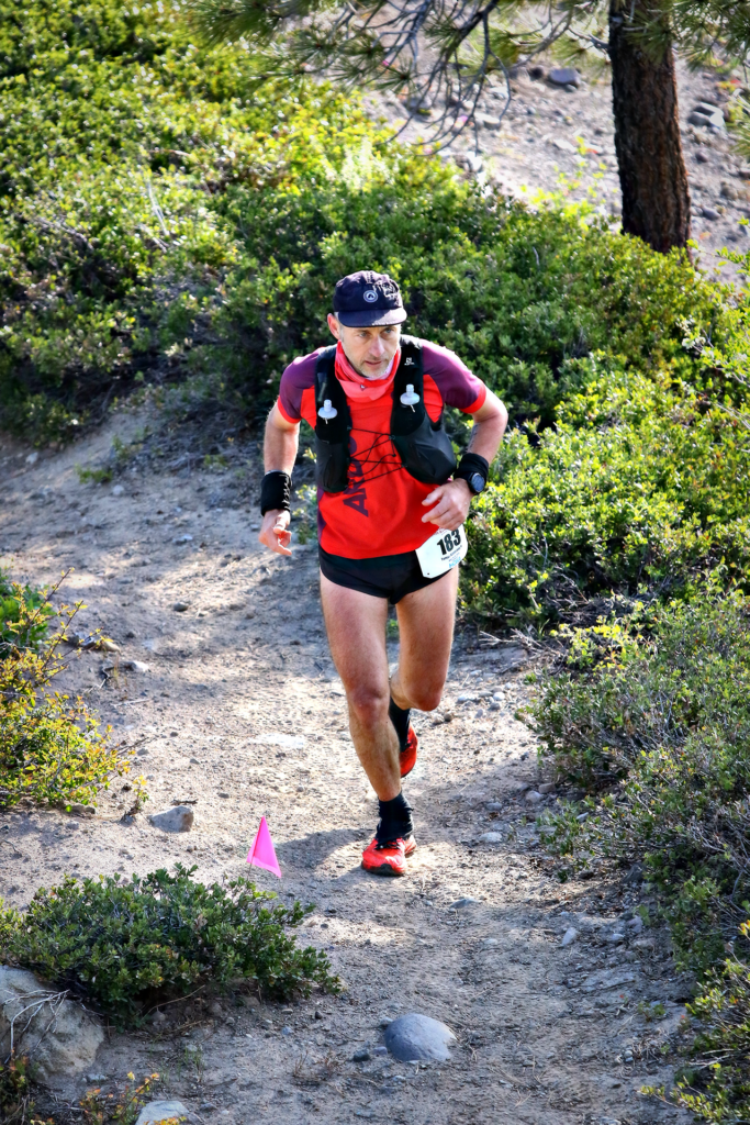
The gun goes of, and I am trying to come in to a nice rythm. The uphill is not that steep, so I mix hiking and running, paying attention to my pulse and general feelings. Two days ago when I hiked this section to highcamp, I felt the high altitude, and had shaky legs, so I did not want to stress. Soon the trail transformed into snow, but it was hard in the cold morning temperatures. After 45 minutes, I saw and heard the front runners up at the Escarpement, and I was there some 10 minutes after. And then we headed down. On fresh legs and a nice downhill, I passed many runners before we went into the snow again. I passed a lot of runners here as well, the snow was no problem for me, and soon I got to the first aidstation at Lyons ridge. I filled one bottle, and grabbed som gels and pushed on.
Section 2 – Lyon Ridge to Red Star Ridge
| Total time | Position | Total distance | Time | Distance | Speed |
| 3:28:48 | 50 | 25,4 km | 1:13:18 | 8,8 km | 8:17 min/km |
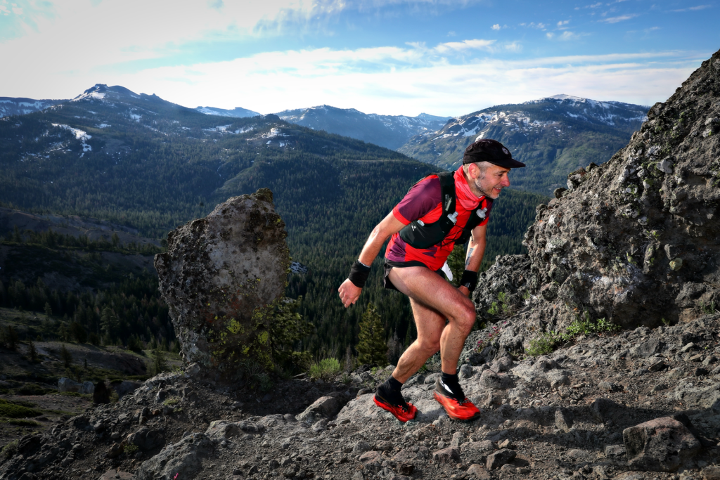
Running in stunning environments in the high country, legs are fresh and I have found my place in the pack. Still a lot of snow, and sometimes quite hard terrain. There are now big climbs or downhills, but a lot of ups and downs. The sun starts to feel warm, and I’m just cruising at a controlled pace, enjoying life.
Section 3 – Red Star Ridge to Duncan Canyon
| Total time | Position | Total distance | Time | Distance | Speed |
| 4:50:51 | 48 | 39,3 km | 1:22:03 | 13,8 km | 5:56 min/km |
Still in the high country, but there is less snow now. Just some stretches here and there. I’m starting to get into a good pacing here, the terrain is easier to run, and there are no big climbs, just small ups and downs that are very runnable. I’m checking my pacing compared to the 24 hour scheme, and for the first time I’m ahead of the timetable, now with 10 minutes. It didn’t feel like it, but I must have pushed a bit more on this section.
Section 4 – Duncan Canyon to Robinson Flat
| Total time | Position | Total distance | Time | Distance | Speed |
| 6:16:16 | 50 | 48,8 km | 1:25:25 | 9,5 km | 9:00 min/km |
After a long section with mostly downhills, this section is a long climb up to Robinson Flat. I still have good energy, and the legs are working fine. The uphill is not very steep, so I mix hiking and running to keep the same effort as before. The sun starts to get really warm now, but I have got enough fluids throughout the entire sections. A passing of a big river wading up to the waist cools me of quite a bit. The only thing that is worrying me a bit is that my old wristbands are starting to feel a bit tight, so I’m trying to massage the lymphatic system to get less swollen. At Robinson Flat I have my first drop bag, and there is a big crowd cheering me on as I approach the aid station. The steps gets lighter, and take in every moment. At the aid station, I cut my wristbands of, and also dump some of the warmer gear I had since the morning.
Section 5 – Robinson Flat to Miller’s Defeat
| Total time | Position | Total distance | Time | Distance | Speed |
| 07:00:00 | 50 | 55,3 km | 43:44 | 6,6 km | 6:38 min/km |
According to the temporary elevation tattoo on my arm, there is a long stretch of downhill running for the next three aid stations. The first one is mainly gravel roads. Runnable all the way, even though the speed is a bit slow on average, but that’s because the stop time at the last aid station is included.
Section 6 – Miller’s Defeat to Dusty Corners
| Total time | Position | Total distance | Time | Distance | Speed |
| 07:35:12 | 50 | 61,1 km | 35:12 | 5,8 km | 6:05 min/km |
Keeping a good pace, but it’s starting to get hot! Putting ice in my cap at the aid station, and that takes the headache away. Eating and drinking still works fine, and I can keep the pulse up in z2-23 in the uphills still, which is a good sign.
Section 7 – Dusty Corners to Last Chance
| Total time | Position | Total distance | Time | Distance | Speed |
| 08:27:00 | 51 | 69,7 km | 51:48 | 8,5 km | 6:04 min/km |
The last stretch of the downhill section, and I’m getting into a nice routine. Filling up one bottle with GU Roctane energy, grabbing two gels, som ice in the cap, and quick through the aid station. Now I’m almost 40 minutes ahead of the 24 hour schedule, and I’m feeling great!
Section 8 – Last Chance to Devil’s Thumb
| Total time | Position | Total distance | Time | Distance | Speed |
| 09:41:08 | 55 | 76,9 km | 1:14:08 | 7,2 km | 10:14 min/km |
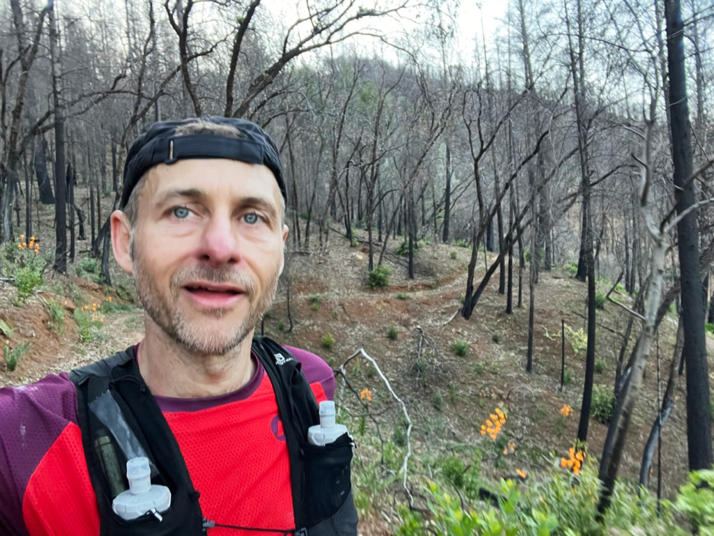
A long steep downhill where I can go all out for the first time, finnaly! This is how I thought the downhills would be. What others dread, I welcome at this point. But I also know, that after a long downhill comes a long uphill, and the climb to devils thumb is where I felt the energy getting drained from my body. Halfway up, the forest is burned away since last years big fire, and the sun is burning very hot at this time. I must change down a gear or two, and people are passing me on the way up to the aidstation. Once I’m there, I’m starting to feel nausea, and cannot eat anything more. I’m hoping that the long downhill to El Dorado Creek will fix this.
Section 9 – Devil’s Thumb to El Dorado Creek
| Total time | Position | Total distance | Time | Distance | Speed |
| 10:40:00 | 54 | 85,1 km | 58:52 | 8,2 km | 7:10 min/km |
The downhill is not as steep as it looked on the map, and I’m still feeling a bit low. I can still drink energy drinks and gels, And I keep the pacing up on the downhills. But I know that If I don’t turn this around, it will be hard to keep the 24 hour pacing. Even though I’m passing the halfway point now, and on around 10 hours, this is where I need to start grinding to make it. At this point, I’m quite confident that I will make the cutoffs, since I have 20 hours left and only 80 km to go. But I also know that anything can happen still.
Section 10 – El Dorado Creek to Michigan Bluff
| Total time | Position | Total distance | Time | Distance | Speed |
| 11:42:30 | 57 | 89,6 km | 1:02:30 | 4,5 km | 13:52 min/km |
At the El Dorado Creek aid station, I heard a voice talking to me in Swedish, and he told me that I was the first male swede to pass there. Ida passed some 1,5 hours earlier. I still felt the nausea, but they had fresh berries and orange juice, and the orange juice was like a dream for my stomach! Reminder to self, and orange juice in drop bags. I took a paper bag with berries with me, and started the long climb up. I had to ge quite slow here, with low energy and nausea, but finally got to the top. I had my next drop bag at Michigan Bluff, and there I would get a short break while arranging my gear preparing for the night.
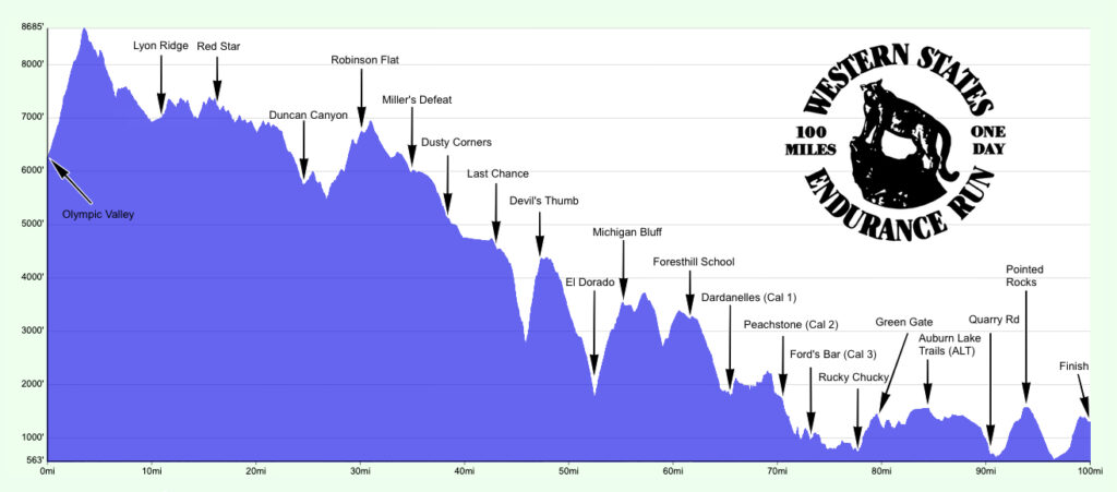
Section 11 – Michigan Bluff to Foresthill
| Total time | Position | Total distance | Time | Distance | Speed |
| 13:13:12 | 59 | 99,8 km | 1:30:42 | 10,1 km | 8:57 min/km |
I tried to eat some white bread, but could not manage to get it down. Since I’m still able to drink and take gels, that’s no big deal. I can finish the race only on liquids. But I’m craving orange, and the only have the thick gels now, and my stomach is not a fan of those. I take the headlight and night gear at this station, knowing that I’m ahead of schedule and wont need to use it any time soon. I have packed night clothes, but changing to long sleeves as it still is over 30 degrees seems a bit to much, so I leave it in the bag and continue with the same clothes that I have had since the start.
I can’t handle any of the gels I have, so I’m at a low right now, trying to run when I can. The uphills on this section are runable, but I don’t have the energy for that at the moment, so I focus on getting through running the flats and the downhills.
Section 12 – Foresthill to Dardanelles (Cal-1)
| Total time | Position | Total distance | Time | Distance | Speed |
| 13:54:00 | 59 | 105,7 km | 40:48 | 6 km | 6:51 min/km |
The road out of Foresthill was packed with people cheering, a magical feeling! GU had a tent on the way out, so I stopped to see if they had any more of the liquid gels that I could, and they had! Only Cola ones, but I could work with that. This section has changed due to problems with the landowners, so it’s a long stretch with asfalt running. The markings are hard to see, and I need to stop and correct my course a lot of times, since the course on my watch is off from the new one. Still, a bit more energy, and only to grind on.
Section 13 – Dardanelles (Cal-1) to Peachstone (Cal-2)
| Total time | Position | Total distance | Time | Distance | Speed |
| 15:02:00 | 62 | 113,8 km | 1:08 | 8 km | 8:27 min/km |
On the trail again! Mostly uphills on this section, and I get passed by some runners on the uphills where I need to hike. But I feel the energy slowly coming back again, And I’m looking forward to the river crossing.
Section 14 – Peachstone (Cal-2) to Ford’s Bar (Cal-3)
| Total time | Position | Total distance | Time | Distance | Speed |
| 15:37:00 | 59 | 117,5 km | 35:00 | 3,7 km | 9:27 min/km |
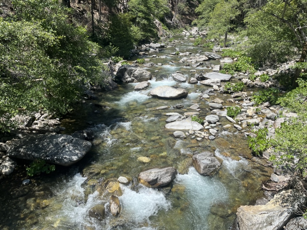
At the Peachstone aid station, just as I’m about to exit, a shirtless man runs straight through the aid station. The officials tells him that he is second in M50, which means that I’m third. I look at the elevation tattoo, and see a long downhill, and I think that the next aid station is the river crossing. I know that I don’t have the power at the moment to match his uphill pace, but I want to stress him a bit, and beat him across the river. So I push the downhill hard, pass him quickly, and leave him behind me. He doesn’t catch me in the uphills that come, but there is no river crossing, so we enter Fords Bar together.
Section 15 – Ford’s Bar (Cal-3) to Rucky Chucky
| Total time | Position | Total distance | Time | Distance | Speed |
| 16:42:16 | 63 | 125,5 km | 1:05:16 | 8 km | 8:07 min/km |
The shirtless man passes me, and I cannot keep up with his pace. I have to walk all the uphills now, and there’s a lot of them. The darkness starts to fall, and I put on my headlight. As I reach Rucky Chucky it is dark, and an amazing aid station awaits! I have my third and last drop bag here, and I’m now almost 1,5 hours ahead of the 24h pacing. The silver buckle is within reach.
Section 16 – Rucky Chucky to Green Gate
| Total time | Position | Total distance | Time | Distance | Speed |
| 17:27:00 | 65 | 128,4 km | 44:44 | 2,9 km | 15:27 min/km |
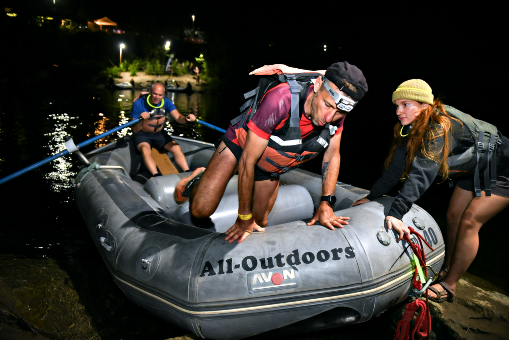
The river is higher than normal, so there are rafts that takes us to the other side. Lights are draped across the passing, and there is music and party feeling. I’m starting to feel the soles of my feet blistering, but I choose to not take the shoes of at this time, afraid that I will tear the skin of if I change socks. There’s only a marathon left, and I decide to ignore the feet at this time. The section ahead is pure uphill, and I cannot match the hiking speed of the runners around me, so I let them pass me.
Section 17 – Green Gate to Auburn Lake Trails
| Total time | Position | Total distance | Time | Distance | Speed |
| 18:46:00 | 66 | 137,1 km | 1:19:00 | 8,7 km | 09:06 min/km |
Another section with rolling trails, but it is still mostly uphills, and I’m still low on energy. Trying to keep the pacing towards 9 min/km on average, so I have a chance on the silver buckle. But it is dark now. And I’m alone where everybody else has pacers. And there are a lot of animal noises in the bushes. I’m just hoping that I don’t run in to a bear. There have been bear droppings on the trails, but they seem to avoid me.
Section 18 – Auburn Lake Trails to Quarry Road
| Total time | Position | Total distance | Time | Distance | Speed |
| 19:53:26 | 60 | 145,9 km | 1:07:26 | 8,8 km | 07:37 min/km |
After Auburn lake something happens. I’m startin to feel strong again. I can run again, even on the small uphills, and I get the speed up to a good relative pacing, because I pass a lot of the runners that have passed me the last sections. And I run a lot faster now, clocking in km times around 5:30 on the flats. And there’s not much left now.
Section 19 – Quarry Road to Pointed Rocks
| Total time | Position | Total distance | Time | Distance | Speed |
| 20:57:56 | 62 | 151,7 km | 1:04:30 | 5,8 km | 11:08 min/km |
Again an uphill section, to steep to run, so I push the hiking as hard as I can. And the energy is back here as well. The uphill is surprisingly steep, compared to other uphills. I imagined more cruising on the last section towards the finish, but this is nothing like that.
Section 20 – Pointed Rocks to Robie Point
| Total time | Position | Total distance | Time | Distance | Speed |
| 22:07:34 | 61 | 159,1 km | 1:09:38 | 5,8 km | 09:24 min/km |
On the downhill from Pointed Rocks I let my legs free, and push hard. I know that this is the last stretch, and from Robie Point and in there is just a short easy sprint towards the finish line. But again, the uphill feels massive at this point, and it is quite steep as well. But I know that this is the final climb, so I push as hard as I can, passing one more runner on the way.
Section 21 – Robie Point to Finish
| Total time | Position | Total distance | Time | Distance | Speed |
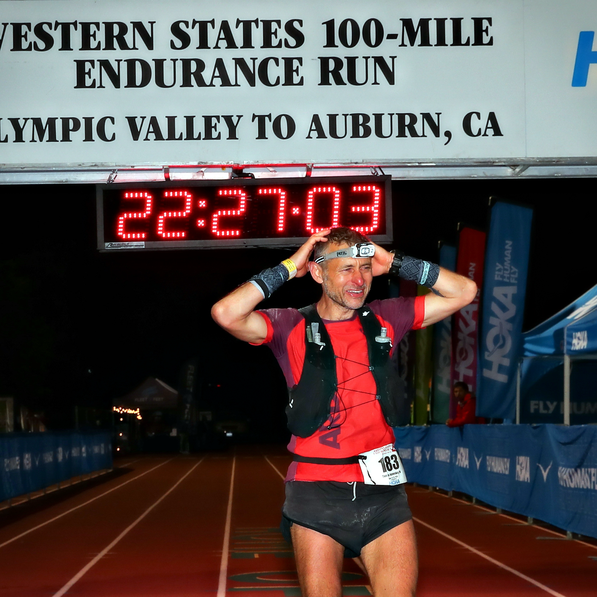
| 22:27:01 | 61 | 161,2 km | 19:27 | 2,1 km | 09:18 min/km |
After Robie Point there is still some climbing left until the road starts rolling down. Following the blue footprints towards the finishline, I’m getting emotional again. Turning over the last bridge before Placer High, and on to the final lap. I see the camerawoman following me, I hear the words that I wrote down before the race from the speakers.
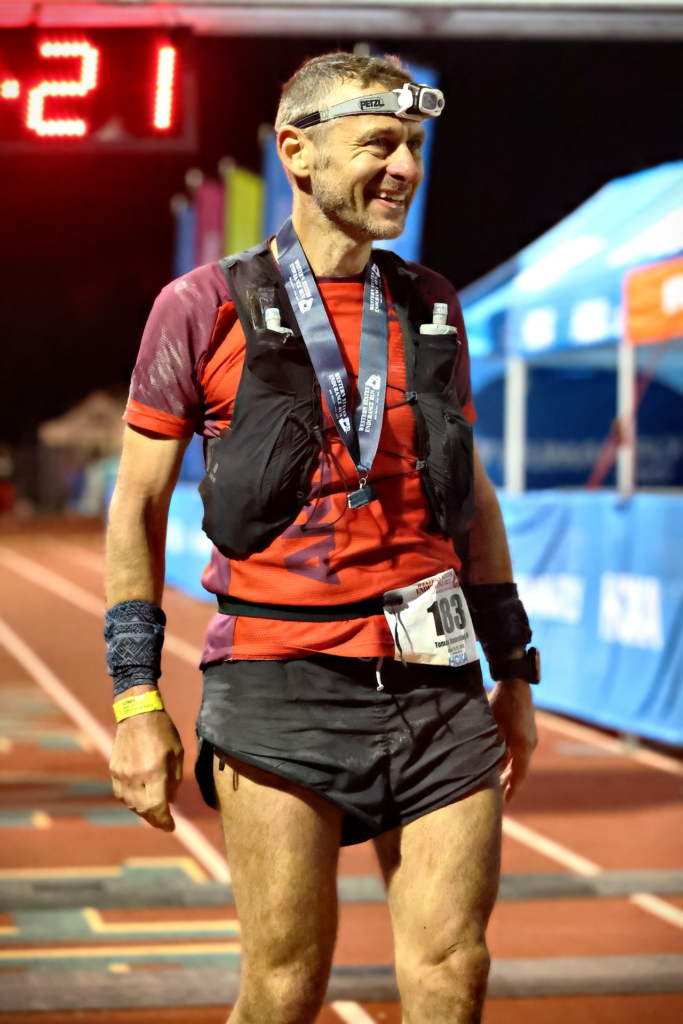
“Number 183, Tomas Amneskog from Sweden. He has finished 38 ultramarathons. Married to Linda and father to Tor, Myra, Irma and Frej “
And just like that, I am done.
I ran the dream. And it was beautiful.